Grid or Curving Streets: Two Ways to Find Your Bearings
Grid or curving streets shape how you find your bearings. Learn how blocks, bends and landmarks make a neighbourhood easier to understand and remember.
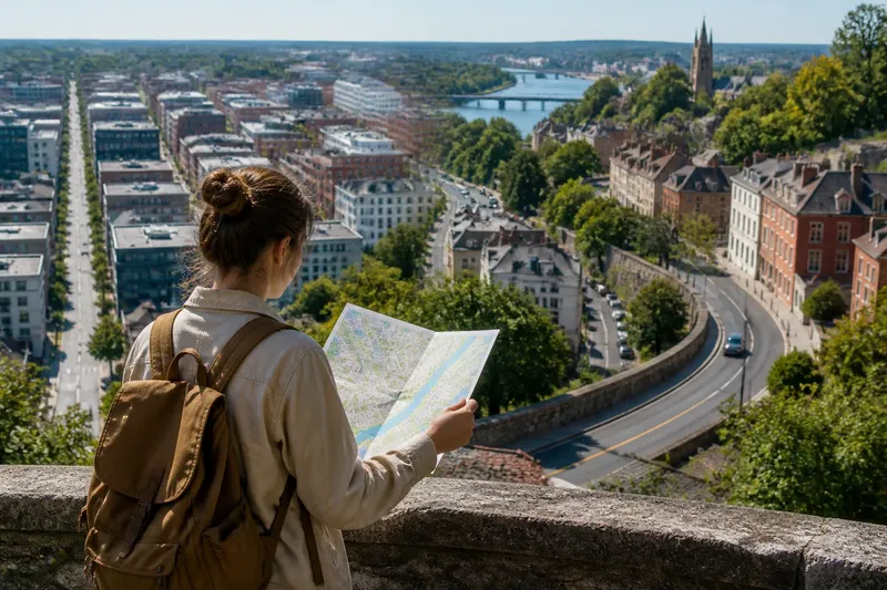
Grid or curving streets: which pattern makes it easier to understand an unfamiliar neighbourhood? A grid offers repeated blocks and crossings; a curving street pattern changes direction with bends, slopes or older boundaries. Neither is automatically clearer. What matters is how the street pattern helps you build a picture of the place.
A grid makes direction easier to hold
In a regular grid, streets meet at frequent junctions and blocks tend to repeat. Once you know that a destination lies towards the river or away from the station, you can use the same general direction at successive crossings. The pattern makes the relationship between streets easier to grasp.
This is useful when a journey can be described by direction rather than by a chain of distinctive places. You might cross several parallel streets, then turn towards a station. If you choose the wrong crossing, the surrounding pattern can help you understand how the blocks fit together.
Repetition has a drawback: one block can look much like the next. A grid may be clear on a map but less distinctive at pavement level, especially where shopfronts, building heights and trees repeat. Think of it like a chessboard: the pattern is easy to see, but you still need to know which square you are looking at.
Bends reveal how a neighbourhood fits its setting
Irregular streets may follow a hillside, river, older property boundary or route that developed before the surrounding area. Their shape can be harder to anticipate from a map, but it often reflects something about the land or the neighbourhood’s history.
A bend changes what you can see and how one street connects to another. A broad curve may lead towards a view or a junction; a sharp turn may mark a boundary or a change in slope. This makes the pattern more sequential than a grid: you understand it by seeing how each section relates to the next.
Curves can make direction harder to judge, though. A street may seem to lead away from a destination while gradually arcing towards it. Rather than treating each bend as a separate navigation problem, look at the street’s overall shape and note how it meets larger roads or prominent features.
Landmarks help distinguish one street from another
Landmarks add identity to a pattern. A railway bridge, market entrance, church, clock tower or distinctive building can show which part of a grid you have reached or confirm that a winding street has passed a particular junction.
Choose features that are visible from the public route and easy to tell apart. A bridge crossing a railway line may be more useful than a row of similar cafés; a prominent park gate may be easier to identify than a distant rooftop. A few different cues can give a neighbourhood a memorable structure without requiring you to remember every street name.
Say you are going from a tram stop to a library in a district with a regular grid. The library is beside a distinctive stone arch, and the river marks one edge of the area. You identify the river-facing side on the map, follow the parallel streets towards it, then use the arch to recognise the library’s block. The resulting mental picture has two anchors—the river and the arch—instead of a string of turns.
Choose the pattern that suits the place?
Neither street pattern is always easier. The clearest way to understand a neighbourhood is to combine its broad geometry with features that distinguish one part from another.
Is a grid always easier to understand?
No. Repeated streets make direction and block relationships clear, but similar-looking corners can be hard to distinguish. A named crossing or distinctive building can help identify the right part of the grid.
Do curving streets make a neighbourhood confusing?
Not necessarily. Bends, slopes and views can create a memorable sequence, especially when the street connects to recognisable places. The pattern is harder to read if those changes offer no clear relationship to other streets or landmarks.
What helps a grid feel less repetitive?
Notice features that vary between blocks, such as a park entrance, a bridge, a different building frontage or a major cross street. These cues give repeated geometry a local identity.
Why do some streets curve rather than follow a grid?
Some streets reflect the land, older boundaries or routes that existed before later development. A bend can therefore show how the neighbourhood relates to a slope, waterway or earlier pattern of use.
Compare street patterns through their relationships
A map can show whether streets run parallel, meet at right angles or curve around an obstacle. To understand the neighbourhood itself, look at how those lines connect: where the main roads cross, which streets lead towards open space, and where a railway or canal interrupts the pattern.
Notice how the pattern changes from one area to another. A grid may break around a park or railway station; an irregular district may contain a few straight avenues. These transitions can explain why one part feels orderly and another feels more varied.
For instance, imagine a neighbourhood where straight residential streets stop at a railway cutting, while a curved road follows its edge to a bridge. On the map, the grid explains the local blocks, while the curved road explains how people pass the barrier. Seeing both relationships gives a fuller account of the street pattern than calling the area simply regular or irregular.
Most neighbourhoods combine regular and irregular streets
Street patterns are rarely pure examples of one type. A district may begin with a grid and become less regular near a river, park or older centre. The useful question is not which pattern wins, but what each section makes visible: direction and repeated crossings in one place, landform and sequence in another.
When a neighbourhood feels difficult to understand, look for the cause in its shape. Repeated blocks may need a landmark to make them distinct; an unexpected curve may make more sense alongside a slope or boundary. The phrase grid or curving streets is a starting point for noticing those differences, not a verdict on whether a place is easy to read.