The Shortcut That Is Not Always the Quicker Walk
The quickest walking route is not always the shortest. Learn how crossings, pavement access and route familiarity shape a safer, smoother journey.
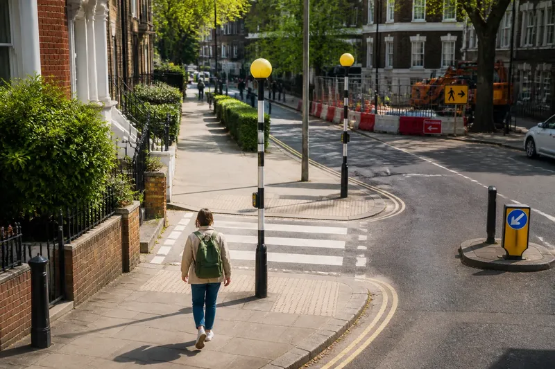
Which route gets you there sooner: a straight line across the map or a longer walk along streets? The quickest walking route depends on what the journey asks of you: a signal wait, a blocked pavement or a difficult turn can interrupt a direct route. For a familiar trip, notice which parts repeatedly make you stop, then decide whether a different public route would suit you better.
Crossings and access can outweigh a short distance
A map reduces a walk to a line. On the pavement, that line becomes choices: wait at a signal, follow a diversion around building work, or find a dropped kerb that lets you cross. These details can shape a journey more than the apparent distance between two points.
Think of a route as a coat with pockets: the main shape may be simple, but what each pocket holds changes how useful it is. Here, the pockets are the practical details—crossing locations, pavement conditions, steps and entrances—that determine whether the route works for your particular journey.
- Crossings: Check whether a crossing is on your side of the junction and serves your direction of travel. If it requires a detour, decide whether that is preferable to waiting at an awkward junction; otherwise, use a clearly accessible public crossing.
- Pavements: Look for barriers, narrow stretches, surface damage or queues. If the path remains clear enough for your needs, continue; if not, choose a signed public alternative rather than squeezing past an obstruction.
- Steps and kerbs: Check for steps, dropped kerbs and a usable route into the destination. If the route is accessible for your needs, keep it in consideration; if not, check another public approach or seek local access information.
- Turns and signs: Notice whether a turn is clearly marked and easy to follow. If it is, the route may be straightforward; if it is not, favour a recognisable street route over an uncertain cut-through.
- Temporary activity: Observe whether deliveries, queues or works are blocking the way. If the obstruction appears occasional, treat it as a changing condition; if it recurs, consider another route for the journeys when it matters.
- Personal needs: Consider what you are carrying and who is walking with you. If a route’s surface and crossing space suit those needs, retain it as an option; if they do not, choose a more suitable public route.
Keep these observations distinct. A route may be easy to follow but include a crossing that is difficult for you. Another may have an accessible crossing but require a longer approach. Naming the particular difficulty makes the choice clearer.
Compare the routes by the decisions they require
You do not need a stopwatch or an app to compare familiar options. Ask what each route requires you to do: wait for a signal, cross at a particular junction, negotiate steps, or find an entrance. The useful comparison is not simply which line is shortest, but which route you can use safely and comfortably under the conditions you expect.
Say you usually walk to a station through a passage and then cross a busy junction. Imagine the starting point is your front door, the destination is the station entrance, and the passage has no step-free alternative at its far end. You check a parallel street on a public map, confirm it reaches the same station entrance, and walk it once in ordinary conditions. The new route has a longer approach but avoids the passage and offers a crossing that suits your needs. The resulting decision is to use the parallel street when the passage is inaccessible, while keeping the familiar route for occasions when its access conditions are suitable.
This example is not a claim that one route is faster. It shows how a concrete access requirement can change which route is usable, even when the map makes another option look more direct.
How should you judge a route that keeps causing trouble?
Is a longer walk with a straightforward crossing a better choice?
It may be, if the direct option repeatedly requires a crossing or pavement manoeuvre that does not work for you. Compare the actual public routes and choose the one that is safer and more comfortable, rather than assuming the shorter line is preferable.
What if a route has steps or a missing dropped kerb?
Do not assume you can get around the barrier safely. Check for a public alternative with suitable access, and consult the local council or transport authority if access information is unclear.
How should you respond to a temporary obstruction?
Follow pedestrian signs and use a public diversion. If the obstruction recurs, treat it as a condition that may affect future trips and identify another accessible public route.
How can you compare routes without timing them?
Compare the decisions and barriers each route presents: where you must cross, whether the pavement is usable, and whether you can follow the route to the entrance. If one option better fits your needs without creating another obstacle, that is a sound basis for choosing it.
Match the route to the journey in front of you
The same street can work differently when a pavement is being repaired, a delivery is blocking the way or a crowd fills a narrow section. For an unfamiliar trip, check a current map and look for public access routes, but remember that a map may not show every temporary barrier or surface problem.
Consider the specific journey. If you are carrying shopping, an even pavement may matter more than a short flight of steps. If you are walking with a child, a crossing with a clear waiting space may be preferable to a more direct junction. If you use a mobility aid, check access details with the relevant local authority or transport operator when the map does not provide enough information.
When a crossing feels unsafe or a route is blocked, do not prioritise speed. Follow pedestrian signs and use an available public crossing. For recurring access problems, a qualified access adviser or the relevant local authority can help clarify suitable options.
Choose the route that removes the barrier that matters
Once you know what makes a route difficult, choose an alternative that addresses that specific barrier without introducing a more serious one. Check where it crosses, whether the pavement continues, and how it reaches the destination. Change one section at a time so the reason for your choice remains clear.
For the quickest walking route on a familiar journey, distance is only one consideration. Check whether the public path is accessible, whether the crossing suits your needs and whether you can follow the route to the entrance. The most useful choice is the one that gets you there safely and comfortably, not simply the one that draws the neatest line.